Case note: Bury Mount, Towcester
A scheduled motte-and-bailey site beside the River Tove: what a heritage-led open space project involved.
The Common Ground editorial deskPublished 5 min read
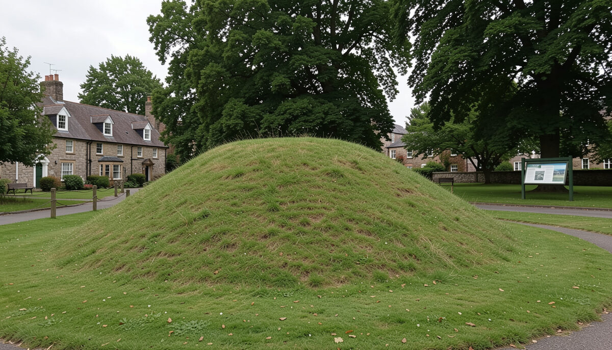
Bury Mount is a Norman motte standing at the western edge of Towcester in Northamptonshire, close to the line of Watling Street, the Roman road that ran through the town known in the Roman period as Lactodorum. The mount is a scheduled monument, a designation that places it among sites of national archaeological importance and gives it legal protection against disturbance or development. This case note sets out what is documented about the site, its use as public open space, and the local authority and community context in which its care sits.
The note is presented in an archived case study format. Where a point rests on established public record, it is stated as such; where the archive does not carry evidence, that absence is stated plainly. The distinction matters, because modest heritage sites of this kind often accumulate assumptions that are hard to trace to any source.
The monument and its documented history
Towcester is one of the oldest continuously inhabited towns in the country, with documented Roman occupation and a mention in the Anglo-Saxon Chronicle in connection with a defensive wall built there in the tenth century. Bury Mount belongs to the Norman period, a castle mound of the type built across England in the years following the Conquest, typically associated with a local lord and with an adjoining bailey enclosing domestic buildings. The mount survives as an earthwork, and its scheduling as an ancient monument is recorded in the National Heritage List for England, which is the authoritative public record for such designations and can be searched at the Historic England list.
What the list records is the designation itself, the location and the broad description of the monument. What it does not record, and what this archive does not evidence, is the detailed sequence of excavation, if any, of the mound, or the full archaeological interpretation of its construction phases. Anyone requiring that level of detail should consult the local historic environment record and any published excavation reports rather than rely on general site descriptions.
Interpretation and public access
Bury Mount has functioned in recent decades as a public open space within the town, valued for its heritage interest and as a green landmark within walking distance of the town centre. Interpretation of such sites commonly takes the form of on-site panels, leaflets and town trails, and Towcester's wider Roman and medieval history has been the subject of local interpretation efforts over the years.
The archive supporting this note does not contain the text of specific interpretation panels at Bury Mount, nor dated documentation of particular improvement schemes. What can be said is that the management of a scheduled monument as open space involves a distinctive set of constraints: ground disturbance, tree planting, paths, play equipment and even mowing regimes can require scheduled monument consent, and local authorities typically work with Historic England on any works affecting the fabric of the site. This general framework is documented in national policy and guidance on scheduled monuments; the specific consent history for Bury Mount is not held in this archive.
- Documented: the existence of the motte, its status as a scheduled monument, its location relative to Watling Street and the town, and the general national framework for managing such sites.
- Not documented here: dated schemes of works, panel texts, consent applications, or named project partners for specific improvement phases at the site.
Council and community context
Responsibility for the site as public open space has rested with the local planning authority. For much of the period in question this was South Northamptonshire Council; under local government reorganisation in 2021 the district councils in Northamptonshire were replaced by unitary authorities, in this area West Northamptonshire Council, which took over parks, open space and planning functions. Town councils, including Towcester Town Council, commonly hold a role in the day-to-day care and enhancement of small urban greenspaces, and community groups and local history societies frequently contribute to interpretation and events.
Community engagement of this kind is now a routine part of open space and heritage projects, and the methods are well established: surveys, workshops and focused work with particular user groups. Comparable approaches are described in the guidance on community consultation practice and in the broader discussion of planning for parks and open space. Whether such exercises were run specifically for Bury Mount, and with what results, is not evidenced in this archive and should not be asserted.
Lessons for open space and heritage practice
Bury Mount illustrates a situation that recurs across the country: a nationally important monument, owned or managed at local level, functioning primarily as everyday open space. Sites of this type benefit from being treated within the open space planning system, with heritage constraints mapped alongside catchments, access and quality assessments. The technique of bringing heritage designations into open space analysis is described in the note on heritage mapping in open space planning, and the wider evolution of open space assessment policy from PPG17 to the NPPF is traced at from PPG17 to the NPPF.
Three points of practice stand out from cases of this kind:
- Protection and use are separate questions. Scheduling protects the fabric of the monument; it does not by itself secure interpretation, access or the quality of the surrounding space.
- Small heritage greenspaces carry a management burden disproportionate to their size, since even routine maintenance may touch on consent requirements.
- Local knowledge, held by town councils, societies and long-standing residents, is often the richest available record of how a site has been used and changed, and is worth capturing before it is lost.
Readers with documentary evidence about specific improvement works, interpretation projects or consent history at Bury Mount are invited to make contact so that this case note can be revised on the basis of records rather than recollection.